Geo Coordinates Plotter - View Bulk Lat Lon on Map
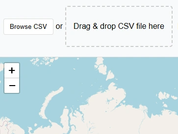
Drag & drop CSV file here
Want to display customer's geographic data on map or project sites coordinates on satellite imagery?
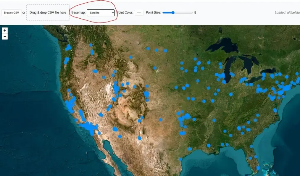
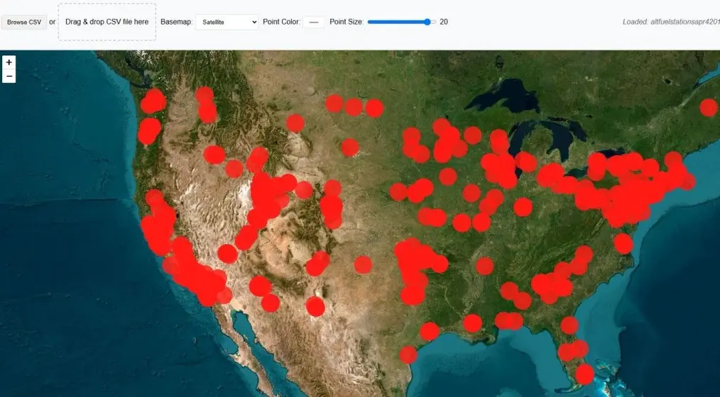
This free app will help you to plot your geographic coordinates on map in no time. You can visualise your data on an interactive map
Just prepare your comma separated file of lat long in decimal degrees and upload to the app. This application will read the coordinates automatically and will display points on the map with two basemap options: Street Map & satellite imagery.
This lat long plotter can be used by many types of users and can be employed in many disciplines that need precise spatial location, mapping, or geographic analysis because lat long are universally accepted reference system to find the geo location.
Key Features of Lat Long Plotter:
Limitations:
As this is a free tool to view your lat long data, there is a limit to view latitude longitude data on map. You can view 500 points on map at a time.
User Guide: Lat Lon to Map Plotter Step By Step Guide:
This free webgis tool is quite straight forward to use. Following guide will teach you about the usage of lat long data plotter on map.
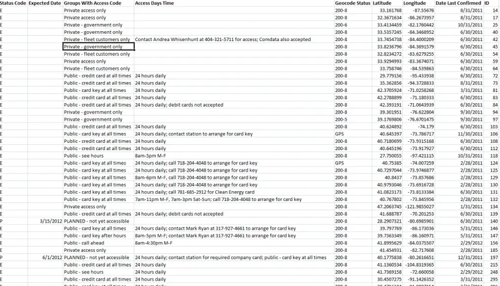
Step 1: Prepare GPS coordinates CSV file
CSV data that contains the geographic point data must have longitude and latitude separate columns. All other attributes should have respective column names. Bellow is sample csv data.
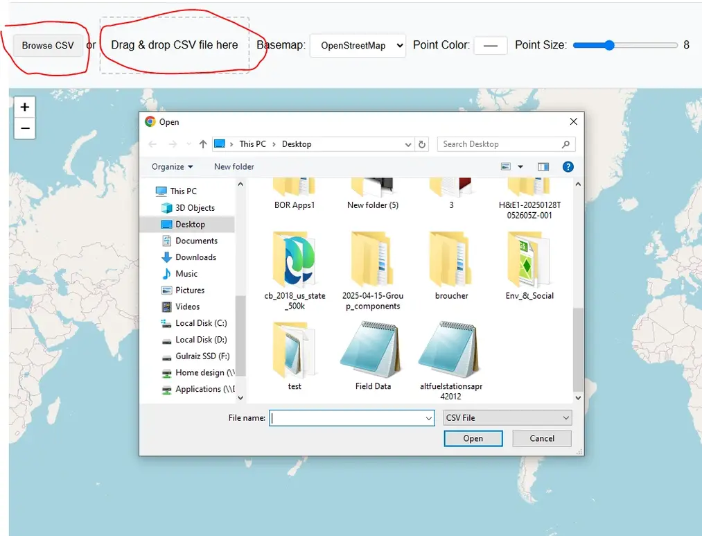
Step 2: Upload or Drag & Drop CSV file
After preparing the csv data with lat lon information stored for each respective point, press “Browse CSV” button or drag & Drop your file in designated area.
Application will automatically detect the data if it is in right format and will upload immediately without pressing any button. Your map will be zoomed to the extent of csv coordinates data.
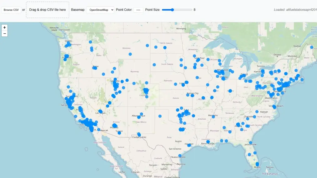
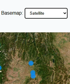
Step 3: Change Basemap
Default basemap is street view by Open Street Maps OSM. Basemap can be switched to satellite imagery.
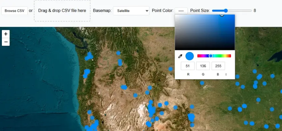
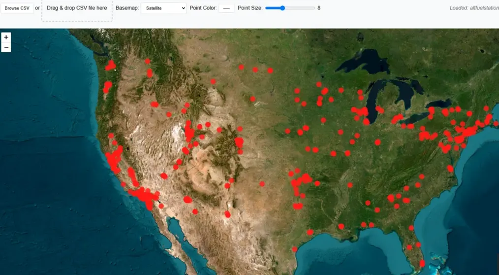
Step 4: Change Points Color
To make map more attractive color of points can be changed from color pallet.
Step 5: Change Point Size
Point size can also be changed using slider from 3 to 20.
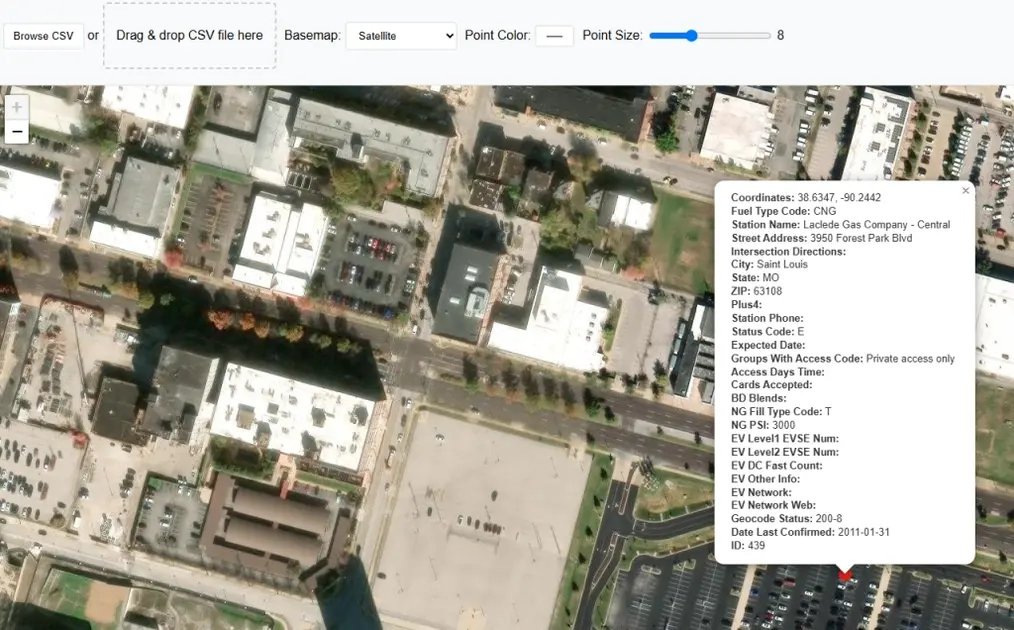
Step 6: Get Popup Information on Point Click
Click on any point on map and a popup window will be appeared, showing stored information of that point along with latitude longitude values.
Open Source Resources
Map Tools Brief Description
-
Radius Map Online – Measure Radius on Map :
Radius Map Tool is a very simple easy to use web map tool. With the help of this tool, you can draw a circle of your desired radius on map at given location. You can easily move and edit the circle on map by changing its color, radius and location. You can download the map as jpg.
-
Calculate Area on Map Online- Land Area Calculator Map:
Area Calculator on map is a free area map tool. This area calculator tool using web map allows you to find out the area in multiple units that is enclosed inside a closed polyline overlaid on a map. You can also download the data in geojson format.
-
Map Distance Finder - Driving & Straight Distance Between 2 Locations:
Distance Calculator on map is a very intuitive& simple free GIS web tool to calculate distance between two locations. It provides street or driving distance as well as straight distance. You can also download route data in the form of geoJSON to use on any GIS software.
-
Elevation / Altitude Finder By Address or Current Location:
Get your current elevation on map using this free online web map application. Just locate yourself on map and get the altitude of specific point. You will get elevation using 90 meter resolution dataset. It means accuracy of the elevation is approximation under 90×90 meters.
-
Zip Code Lookup by Address - Find a Post Code:
To find a zip code (or postal code) for your current location or a specific address, you can use this free tool to mark your position on map and find postcode on single click. Worldwide postal code finder for any address on map makes your life easier.
-
EV Charger Finder - Find Electric Car Charging Stations on Map:
Nearby EV charging station finder on map within United States and get google maps driving directions. This tool will allow you to search street address to find nearest charging port of required location. You can also enter the coordinates or you can use your current geographic location.
-
What is My Current Time Zone - Time Zone Map:
It provides your current GMT time zone, current local time, address date and coordinates worldwide. You can search your address or can use your GPS location. Retrieved information about the time zone can easily be shared on whatsapp.
-
GPX Data Viewer Online - View Hiking, Cycling, Running Data on Map:
Simple user friendly web mapping application to find time zone on map by simply searching the address, postal code, geographic coordinates. You can also search for current time zone by just click my location on map. Click on map and you will be provided detailed information about your current time zone.
-
Shapefile Viewer Online - View GIS Data in .shp Format:
Want to view your GIS data in Esri Shapefile .shp format on map online? Use our shp viewer free application tool to display your shp file format data online. Map can also be exported using this shapefile viewer online application.
-
GPX to GeoJSON Converter
Do you need to convert your GPS data stored in GPX format to well known GeoJSON data. This free web tool will do this job for you. Just upload data, convert and download the required format.
-
KML Online Viewer - Visualize .kml .kmz Data on Map Online
Web Application to view KML, KMZ files on street map and satellite image. View and explore KML and KMZ files online. Fast, free KML viewer shows your placemarks, paths.
-
Coordinates Plotter - Plot Latitude and Longitude on Map Bulk CSV
This online map application provides you with an interactive map made with your own geographic data in CSV file format.
-
Geotag Photos for Free - Batch Editing
Batch-upload up to 10 photos at once, edit EXIF metadata and geotag each image individually in just a few clicks, then export the updated files as high-quality JPEGs.
-
True Size of Countries
The world as it actually is, not just how it’s drawn. How big is your country? Drag it to find out. True Scale. Real Geography. No Distortions.