GPX File Viewer - Get Elevation Profile
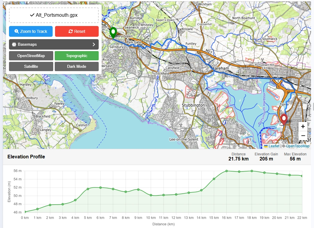
Elevation Profile
Do you want to display GPS data in .gpx format on map and get elevation profile?
View GPX data on map with street view, satellite view, topographic view and dark theme map view as a base map. GPX online viewer is a free and user-friendly online web mapping tool for viewing your GPX tracks files. To get started, just drag your GPX file into the upload area or browse to locate your file in your local directory computer or phone. Our online GPX viewer is 100% free to use and all technologies & datasets are copyright free and works with all modern browser like Chrome, Opera and Firefox etc. You can view your recorded hiking, cycling or any other outdoor activity. This gpx online viewer will show your tracks on map online and will provide total distance covered with elevation profile.
To get started, just drag your GPX file into the upload area or browse to locate your file in your local directory computer or phone. Our online GPX viewer is 100% free to use and all technologies & datasets are copyright free and works with all modern browser like Chrome, Opera and Firefox etc.
You can view your recorded hiking, cycling or any other outdoor activity. This gpx online viewer will show your tracks on map online and will provide total distance covered with elevation profile.
Free GPX Viewer App Key Features:
User Guide: Step by Step Guide to Use GPX Viewer Online:
This guide will help to use online gpx reader to display data on map using free mapping tools.
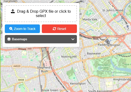
Step 1: Drag & Drop GPX File or Select File from Local Storage
You will have 2 options to upload your gpx file in this gpx file reader. Drag and drop your file in dedicated box as shown in above picture or select file by clicking the box and browse file from your local storage to select and upload.
Step 2: Map Zoom to Data Extent
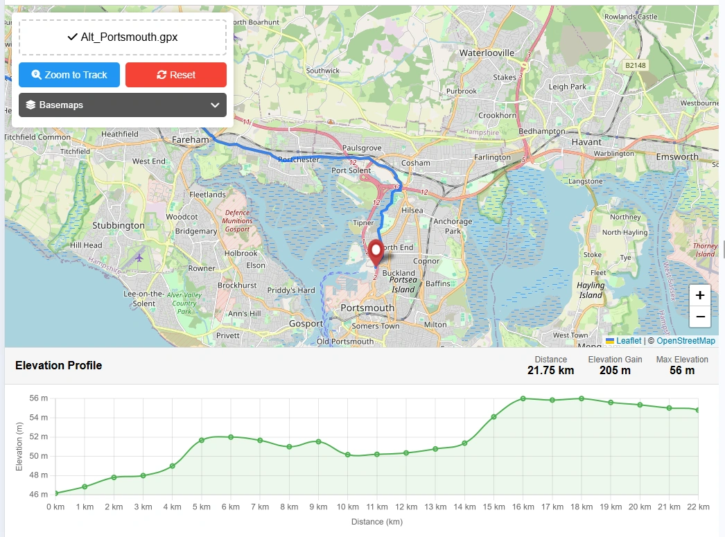
When file will be uploaded then data will be automatically extracted by gpx viewer online application. Map will be zoomed automatically to the extent of gpx data stored in file (Note: GPX file must have track data to display.) This free gpx viewer web tool will provide useful information extracted from data.
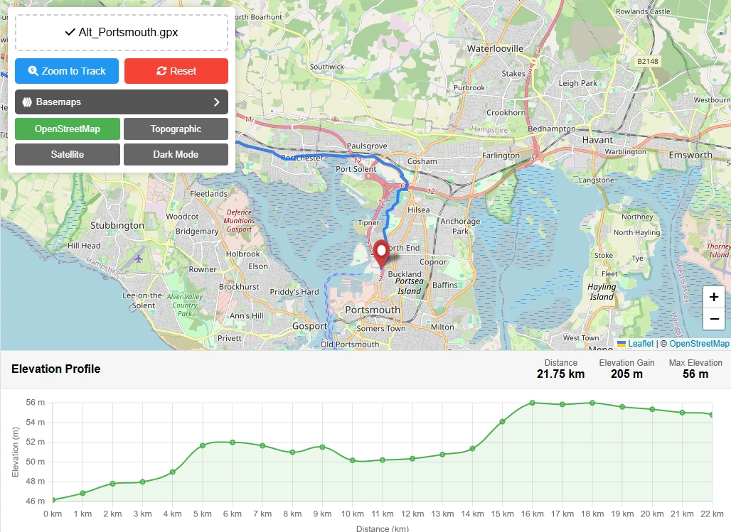
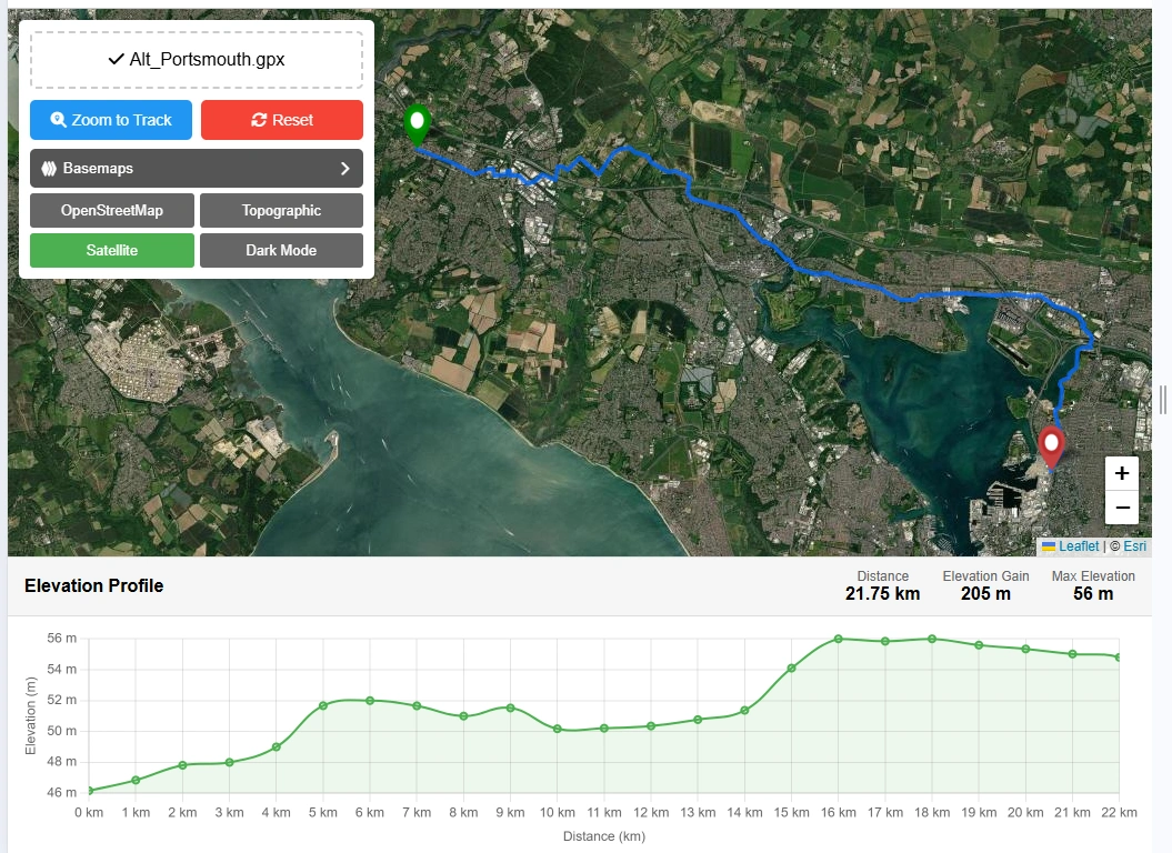
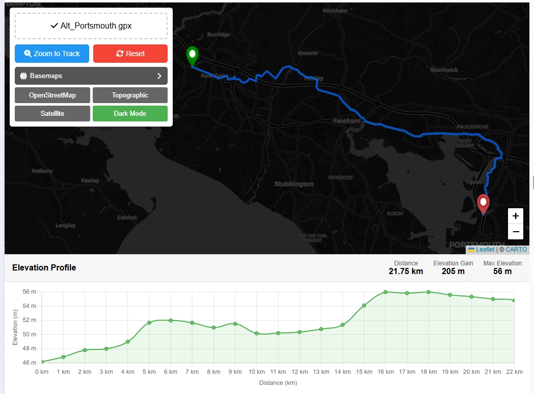
Step 3: Change Base Map
There will be 4 options to change the basemap in this gpx file reader on map.
Step 4: Zoom to Track
Zoom to track button will zoom the data to it original data extent.
Step 5: Reset Map
Reset button will clear all the data and reset the application to its original state to reupload the GPX file.
Open Source Resources
Map Tools Brief Description
-
Radius Map Online – Measure Radius on Map :
Radius Map Tool is a very simple easy to use web map tool. With the help of this tool, you can draw a circle of your desired radius on map at given location. You can easily move and edit the circle on map by changing its color, radius and location. You can download the map as jpg.
-
Calculate Area on Map Online- Land Area Calculator Map:
Area Calculator on map is a free area map tool. This area calculator tool using web map allows you to find out the area in multiple units that is enclosed inside a closed polyline overlaid on a map. You can also download the data in geojson format.
-
Map Distance Finder - Driving & Straight Distance Between 2 Locations:
Distance Calculator on map is a very intuitive& simple free GIS web tool to calculate distance between two locations. It provides street or driving distance as well as straight distance. You can also download route data in the form of geoJSON to use on any GIS software.
-
Elevation / Altitude Finder By Address or Current Location:
Get your current elevation on map using this free online web map application. Just locate yourself on map and get the altitude of specific point. You will get elevation using 90 meter resolution dataset. It means accuracy of the elevation is approximation under 90×90 meters.
-
Zip Code Lookup by Address - Find a Post Code:
To find a zip code (or postal code) for your current location or a specific address, you can use this free tool to mark your position on map and find postcode on single click. Worldwide postal code finder for any address on map makes your life easier.
-
EV Charger Finder - Find Electric Car Charging Stations on Map:
Nearby EV charging station finder on map within United States and get google maps driving directions. This tool will allow you to search street address to find nearest charging port of required location. You can also enter the coordinates or you can use your current geographic location.
-
What is My Current Time Zone - Time Zone Map:
It provides your current GMT time zone, current local time, address date and coordinates worldwide. You can search your address or can use your GPS location. Retrieved information about the time zone can easily be shared on whatsapp.
-
GPX Data Viewer Online - View Hiking, Cycling, Running Data on Map:
Simple user friendly web mapping application to find time zone on map by simply searching the address, postal code, geographic coordinates. You can also search for current time zone by just click my location on map. Click on map and you will be provided detailed information about your current time zone.
-
Shapefile Viewer Online - View GIS Data in .shp Format:
Want to view your GIS data in Esri Shapefile .shp format on map online? Use our shp viewer free application tool to display your shp file format data online. Map can also be exported using this shapefile viewer online application.
-
GPX to GeoJSON Converter
Do you need to convert your GPS data stored in GPX format to well known GeoJSON data. This free web tool will do this job for you. Just upload data, convert and download the required format.
-
KML Online Viewer - Visualize .kml .kmz Data on Map Online
Web Application to view KML, KMZ files on street map and satellite image. View and explore KML and KMZ files online. Fast, free KML viewer shows your placemarks, paths.
-
Coordinates Plotter - Plot Latitude and Longitude on Map Bulk CSV
This online map application provides you with an interactive map made with your own geographic data in CSV file format.
-
Geotag Photos for Free - Batch Editing
Batch-upload up to 10 photos at once, edit EXIF metadata and geotag each image individually in just a few clicks, then export the updated files as high-quality JPEGs.
-
True Size of Countries
The world as it actually is, not just how it’s drawn. How big is your country? Drag it to find out. True Scale. Real Geography. No Distortions.