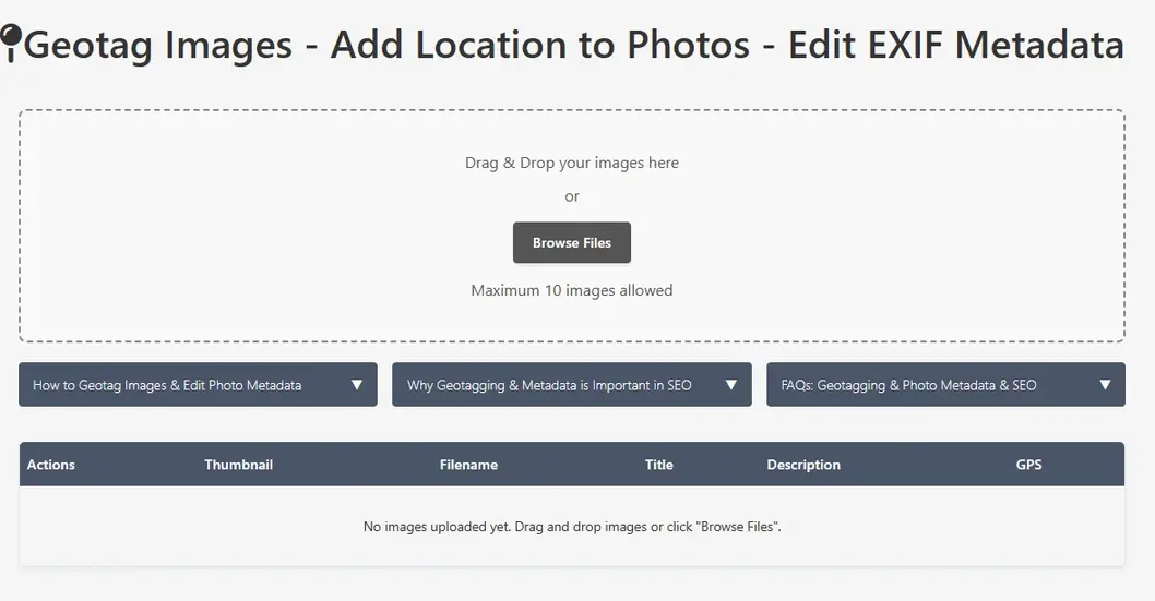
Geotag Images - Add Location to Photos - Edit EXIF Metadata
Drag & Drop your images here
or
Maximum 10 images allowed
- Use drop area to drag & drop image file or browse button to find locally stored file
- File will be uploaded to the browser and will be shown in table row
- Fetched information will be shown with photo thumbnail along with control buttons
- Click the "Edit" button next to the image you want to geotag and edit photo EXIF data
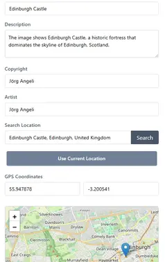
- An Edit window will be opened, Fill up the fields:
- Tittle
- Description
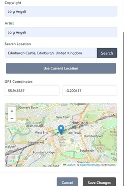
- Copyright
- Artist
- Search for a location using the search box
- Click "Use Current Location" to get your current GPS coordinates
- Manually enter latitude and longitude coordinates
- Drag the marker on the map to the desired location
- Click "Save Changes" to update the image metadata
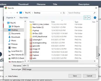
- Click "Export" to download the image with updated EXIF data
- Local Search Ranking Boost: Geotagged images help search engines understand the geographic relevance of your content, improving local search rankings. Images with GPS coordinates stored in EXIF data help search engines to improve search experience of users searching locally like nearby restaurant, school, grocery store etc.
- Image Search Visibility: Search engines use location data to serve more relevant results to user query, it will increase your image visibility in location-based searches.
- Rich Snippets: Geotagged images with stored geo location can also be appeared in rich search results with location information, increasing click-through rates.
- Maps Integration: Images with GPS coordinates data can appear in map searches, driving additional traffic to your website or business from people searching on maps.
- User Experience: Location-aware content provides better context and relevance for users searching for local information.
- Competitive Advantage: Many websites overlook image optimization, giving you an edge by properly geotagging your images.
- Location names (city, neighborhood, landmark)
- What the image depicts
- Your business or service name
- Relevant industry terms
- Natural language that matches how people search
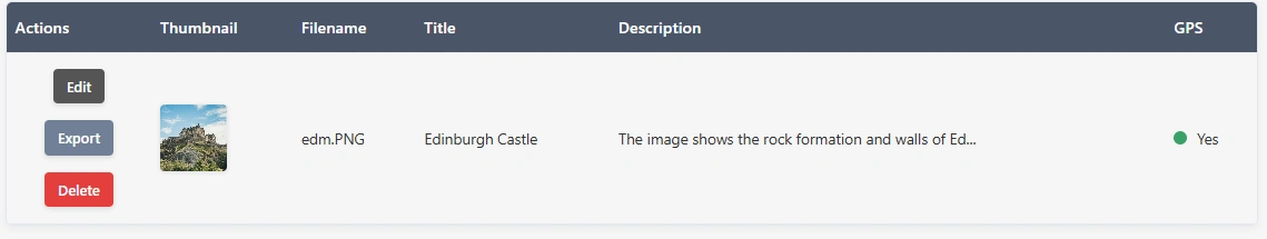
| Actions | Thumbnail | Filename | Title | Description | GPS |
|---|
Looking for to add geographic coordinates to images using geotagging? & Editting EXIF Data of Photos to Enhance SEO?
You can add photos to this app in batch of 10 images at once to add geo-coordinates to each of the file separately. Followed by few clicks your exif data will be updated.
Just upload images to the app and click edit button. Add your desired information in Title, Description, Author and Copyright sections , also add geographic coordinates to geotag the image and hit save button.
Similarly you can repeat this process for upto 10 images at a time and save different information for each image separatly. You can easily export the saved image in JPEG format.
Key Features of Image Geotagger:
Limitations:
As it is a free of cost tool to help SEO professionals, it is limited to edit pictures 10 at a time. Please use it fairly. Max 10 MB Image size is allowed.
User Guide: Geotagger & EXIF Editor App for SEO Step By Step Guide:
This image geotagger is very easy and simple tool to add GPS coordinates to photos accuratly and edit EXIF data like title, description, artist and copyright statement with eas. It may help to boost SEO.
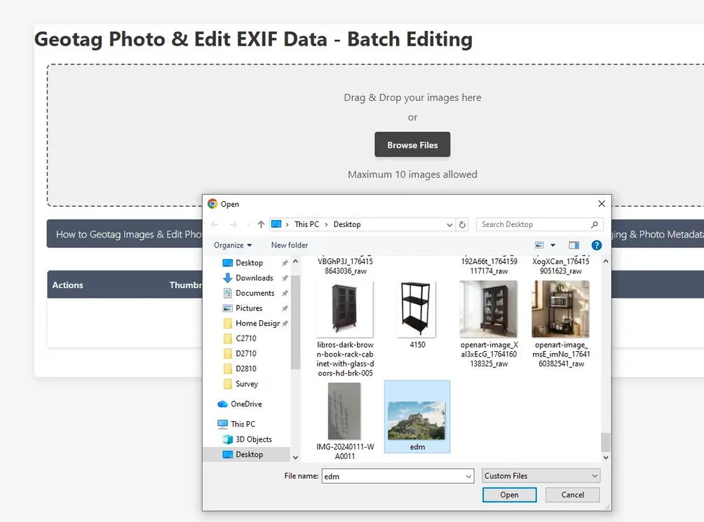
Step 1: Upload image to the application
Interface allows user to upload image via file browser window or user can simply drag and drop the image file. Multiple images can be uploaded one by one.
Select image files.
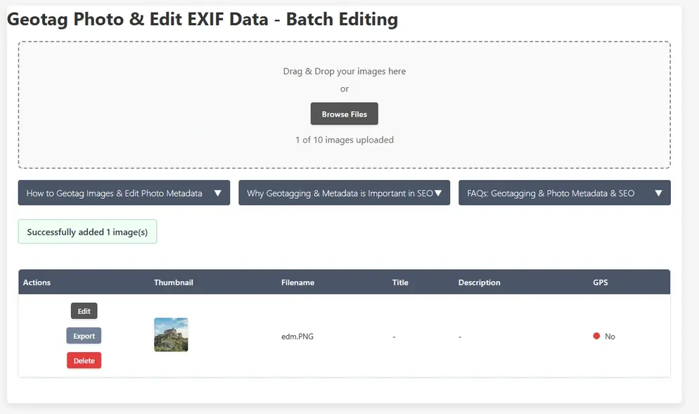
Step 2: Check Image Detalis
Images will be shown in the table along with thumbnails, metadata attributes and GPS information ( If found or not)
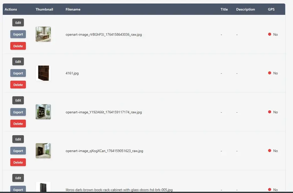
Step 3: Edit Each Image's Metadata along with GPS Data
Now user can edit each image one by one. Each image row in the table has 3 options. Edit, Export and Delete. Click on Edit button then a small imformation popup will be displayed.
User can add tittle of photo, alter or add description of photo, assign author and write a copyright statement. There are multiple options to add GPS coordinates. User can search the location, can add coordinate manually aor can use current location.
Step 4: Export the Images
Now images can be exported by clicking export button and save to local drive.
Open Source Resources
Map Tools Brief Description
-
Radius Map Online – Measure Radius on Map :
Radius Map Tool is a very simple easy to use web map tool. With the help of this tool, you can draw a circle of your desired radius on map at given location. You can easily move and edit the circle on map by changing its color, radius and location. You can download the map as jpg.
-
Calculate Area on Map Online- Land Area Calculator Map:
Area Calculator on map is a free area map tool. This area calculator tool using web map allows you to find out the area in multiple units that is enclosed inside a closed polyline overlaid on a map. You can also download the data in geojson format.
-
Map Distance Finder - Driving & Straight Distance Between 2 Locations:
Distance Calculator on map is a very intuitive& simple free GIS web tool to calculate distance between two locations. It provides street or driving distance as well as straight distance. You can also download route data in the form of geoJSON to use on any GIS software.
-
Elevation / Altitude Finder By Address or Current Location:
Get your current elevation on map using this free online web map application. Just locate yourself on map and get the altitude of specific point. You will get elevation using 90 meter resolution dataset. It means accuracy of the elevation is approximation under 90×90 meters.
-
Zip Code Lookup by Address - Find a Post Code:
To find a zip code (or postal code) for your current location or a specific address, you can use this free tool to mark your position on map and find postcode on single click. Worldwide postal code finder for any address on map makes your life easier.
-
EV Charger Finder - Find Electric Car Charging Stations on Map:
Nearby EV charging station finder on map within United States and get google maps driving directions. This tool will allow you to search street address to find nearest charging port of required location. You can also enter the coordinates or you can use your current geographic location.
-
What is My Current Time Zone - Time Zone Map:
It provides your current GMT time zone, current local time, address date and coordinates worldwide. You can search your address or can use your GPS location. Retrieved information about the time zone can easily be shared on whatsapp.
-
GPX Data Viewer Online - View Hiking, Cycling, Running Data on Map:
Simple user friendly web mapping application to find time zone on map by simply searching the address, postal code, geographic coordinates. You can also search for current time zone by just click my location on map. Click on map and you will be provided detailed information about your current time zone.
-
Shapefile Viewer Online - View GIS Data in .shp Format:
Want to view your GIS data in Esri Shapefile .shp format on map online? Use our shp viewer free application tool to display your shp file format data online. Map can also be exported using this shapefile viewer online application.
-
GPX to GeoJSON Converter
Do you need to convert your GPS data stored in GPX format to well known GeoJSON data. This free web tool will do this job for you. Just upload data, convert and download the required format.
-
KML Online Viewer - Visualize .kml .kmz Data on Map Online
Web Application to view KML, KMZ files on street map and satellite image. View and explore KML and KMZ files online. Fast, free KML viewer shows your placemarks, paths.
-
Coordinates Plotter - Plot Latitude and Longitude on Map Bulk CSV
This online map application provides you with an interactive map made with your own geographic data in CSV file format.
-
Geotag Photos for Free - Batch Editing
Batch-upload up to 10 photos at once, edit EXIF metadata and geotag each image individually in just a few clicks, then export the updated files as high-quality JPEGs.
-
True Size of Countries
The world as it actually is, not just how it’s drawn. How big is your country? Drag it to find out. True Scale. Real Geography. No Distortions.