Map Elevation Finder
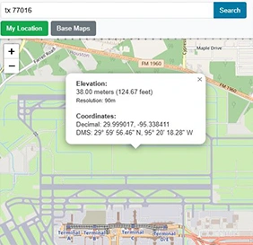
Find the elevation of any location on Earth. Click the map or search by address to get accurate altitude data from SRTM90m.
Open ToolBrowser-based Geographic Information System (GIS) tools — process, analyze, and visualize spatial data entirely within a web browser.
Find the elevation of any location on Earth. Click the map or search by address to get accurate altitude data from SRTM90m.
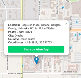
Open ToolFind the postal code or ZIP code of any location worldwide. Click the map or use your current GPS position.
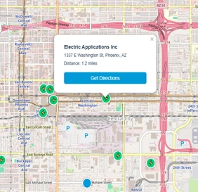
Open ToolFind the nearest electric car charging stations on the map. View up to 10 EV chargers within 25 miles of any location.
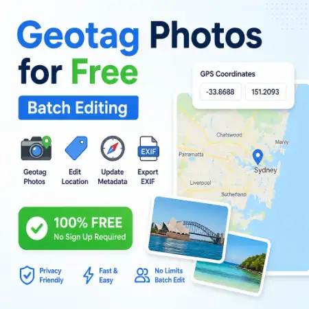
Open ToolAdd or edit GPS coordinates in photo EXIF metadata. Batch geotag JPEG images and export with updated location data.
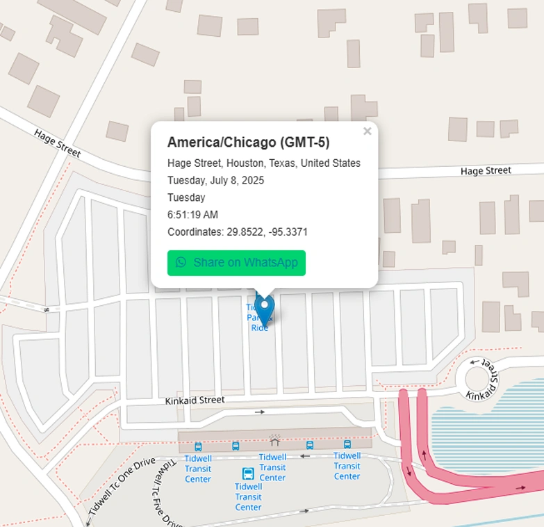
Open ToolFind the time zone for any location. Click the world map to get the timezone name, GMT offset, and current local time.
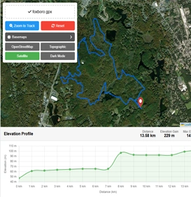
Open ToolUpload and view GPX files on an interactive map with an elevation profile chart. Free online GPX track reader.
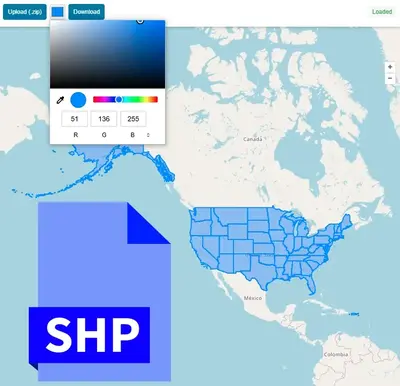
Open ToolUpload and view ESRI Shapefile (.shp / .zip) on an interactive map with an attribute table. Free online SHP reader.
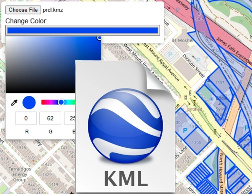
Open ToolUpload and render KML or KMZ files on an interactive map. View Google Earth files online without any software.
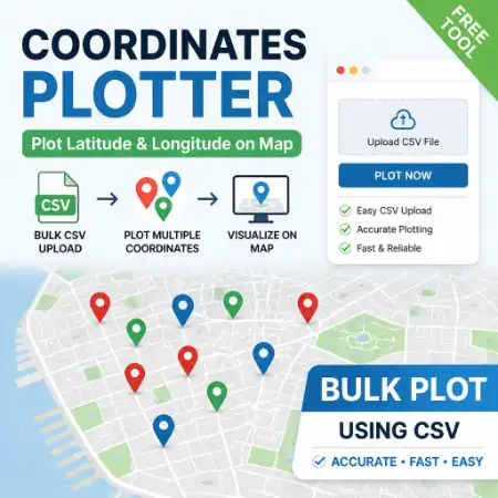
Open ToolUpload a CSV file with latitude and longitude columns and plot all coordinates on an interactive map instantly.
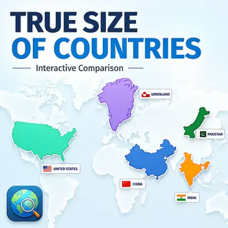
Open ToolCompare the true geographic size of any country by dragging it across the world map. Reveals Mercator projection distortion.
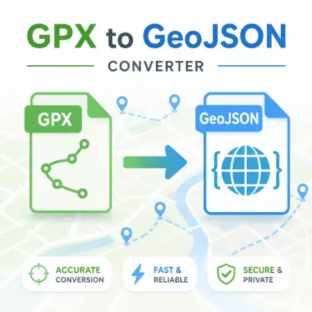
Open ToolConvert GPX files to GeoJSON format online for free. Preview your GPS track on the map then download the converted file.
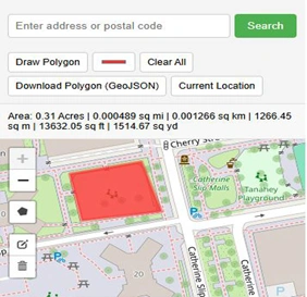
Open ToolDraw a polygon on the map and instantly calculate its area in m², km², acres, or hectares. No sign-up required.
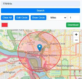
Open ToolDraw a circle of any radius on the map. Switch basemaps and export the map with the circle overlay as a PNG image.
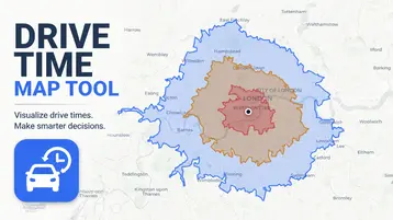
Open ToolCreate an isochrone map, travel time map, or drive time map for any location. Click the map to see what's reachable by car, bike, or foot in minutes.
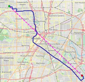
Open ToolMeasure distance between multiple points on the map. Calculate route distances and display results in km or miles.
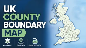
Open ToolView and download UK ceremonial county boundary data as GeoJSON or KML. Interactive map with all 48 counties.
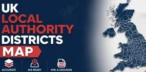
Open ToolView and download UK Local Authority District boundary data as GeoJSON or KML. All ~360 LADs included.
Open ToolBuilt for GIS professionals, field workers, and everyday map users.
Open any tool in seconds — no install, no loading screens, no account.
GPX, SHP, KML, and photo processing is 100% client-side. Files never leave your device.
Desktop, tablet, and mobile. Any screen size. Any modern browser.
All 15 tools are free. No paywalls, no freemium limits, no expiry.
Maplity is a collection of 15 free, browser-based Geographic Information System (GIS) tools for working with maps and spatial data. Every tool runs entirely client-side — there is no software to install, no account to create, and no file upload to a remote server. You open a tool, do the work, and close the tab.
The toolkit covers the tasks that come up most often in everyday mapping work: finding the elevation of a point, measuring distance and area, converting between GPX, KML, and Shapefile formats, plotting latitude/longitude coordinates, locating EV chargers, reading GPS metadata from photos, and looking up postal codes or UK administrative boundaries. Each tool is purpose-built for one job rather than bundled into a general-purpose GIS suite, so there is no learning curve — you can typically get an answer within seconds of opening the page.
A Geographic Information System (GIS) captures, stores, and analyzes data tied to a location on Earth. In practice, that means working with formats like GPX (GPS tracks), KML (Google Earth placemarks and paths), and Shapefiles (the standard format for administrative boundaries and survey data), and being able to answer spatial questions — how far apart are two points, what is the elevation at this coordinate, what area does this polygon cover, or which local authority does this address fall within. GIS tools traditionally required desktop software such as QGIS or ArcGIS; Maplity brings the most common of those operations directly into a web browser.
Because processing happens on your own device, files like GPX tracks, Shapefiles, or photos with embedded GPS metadata are never transmitted to a server for the core conversion or calculation logic. That keeps the tools fast — there is no upload wait — and keeps sensitive location data under your control. It also means the tools work the same way on a desktop, tablet, or phone, since all that is required is a modern web browser.