Calculate the Length of a Path Between Two Locations
Do you want to calculate distance between two points on map?
This free online mapping tool is the answer of your question.
Determining the distance between two locations or addresses is a common question we encounter in daily life. This free web mapping tool will address this question and provide you a detailed answer. You can enter two addresses, postal codes, or coordinates in the 'To' and 'From' text boxes and this distance measuring map application will give you precise results.
This GIS application is built by using open source technologies so it is free to use for a life time.
Salient Features:
Address / Postal Code / Geographic Coordinates Search
This free online distance measurement application allows you to search straight distance and driving distance between two locations. It allows you to enter complete address ( It must be accurate) or Postal code or geographic coordinates in Lat long decimal degree format.
Current Location
Using this online mapping application, you can locate yourself on map to start measuring to your destination. You will need to allow your browser to read your geographic location.
Calculation of Distance in Kilometers and Miles
Mapping distance application will draw straight line between two given points as well as it will draw shortest road route between these 2 given points. Measurement of these 2 lines will be given in km & Miles.
Download the Calculated Route Data
After calculating the distance between two given geographic locations, this free mapping tool will provide the option to download the geographic route data in geoJSON format ( A well known GIS data format accepted worldwide).
Real-World Usage by Profession
User Guide: How to use this free maps distance calculator to measure the distance between 2 points on map?
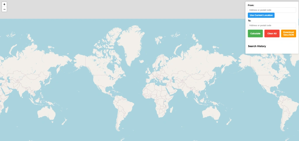
Enter Address From / To:
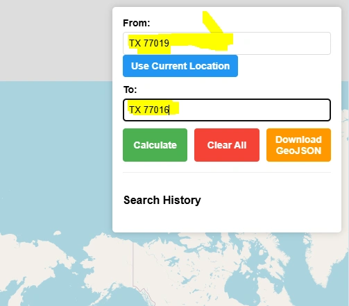
There are 2 text boxes "From" & "To". You can enter street address, postal or zip code or geographical coordinates in decimal degrees latitude longitude.
Use Current Location:
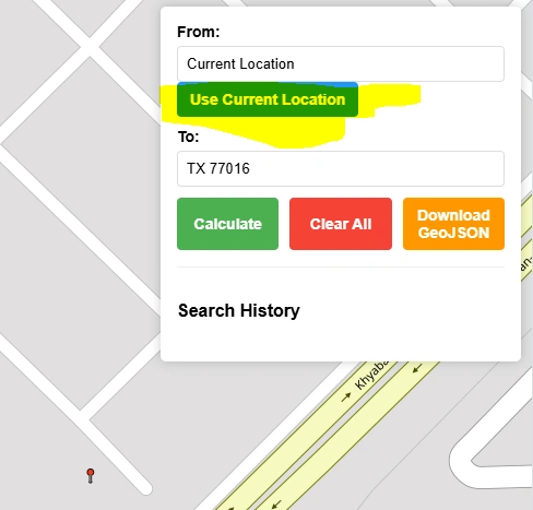
To start from your current location you can simply press “Use Current Location” button. A popup in your browser will show up to allow browser to get your geographic location. Map application will place a marker on map and zoom it to your current location. Now you can enter the destination location in “To” text box.
Calculate Map Distance:
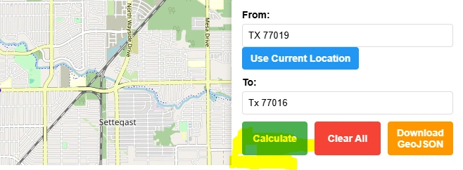
Press “Calculate” button to calculate map distance between 2 given zipcodes or postal codes.
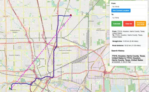
After clicking calculate button it will take a few seconds to run the algorithm to find shortest map distance and will display two polylines on the map. One straight line in pink color which shows straight distance or aerial distance. The other polyline will be in blue color which will show the street path between these 2 geographic locations.
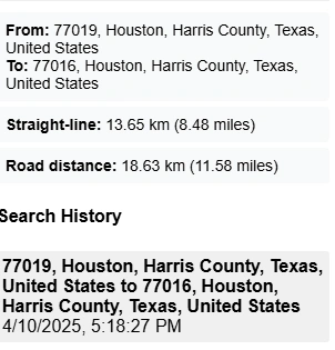
Information panel will show a set of useful information. It will display the addresses of the selected ‘From’ and ‘To’ locations. Straight line distance in kilometers and miles. Road distance in km and miles. It will also keep the history of searches along with date and time until you will press “Clear All” Button.
Clear All:
Clear All button will clear all the results from map and it will reset the mapping application to its initial state.
Download GeoJSON:
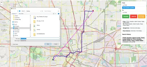
Download option will be available to save route geographic data in geoJSON format on your local computer that can be further used in any well known GIS software.
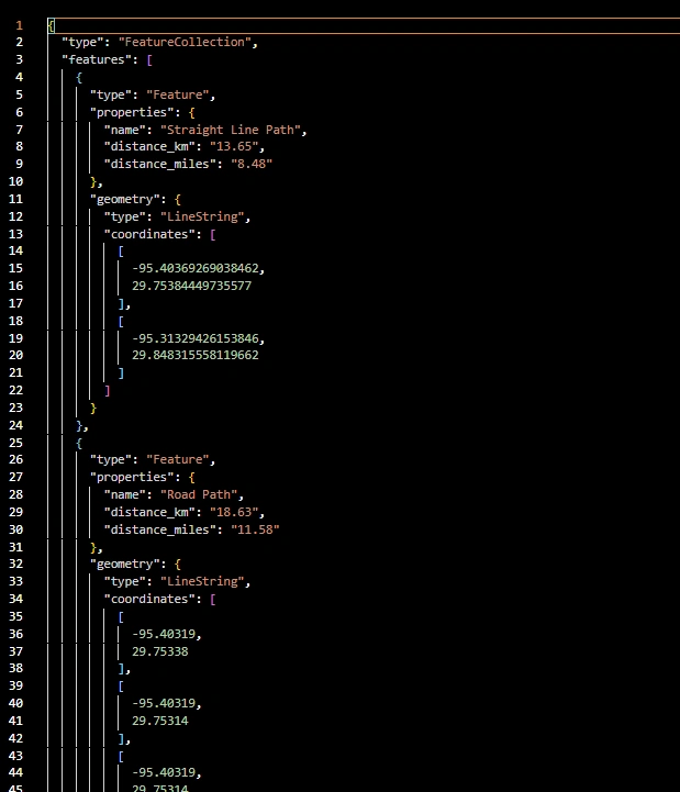
Sample geoJson Data.