GPX File Viewer - Get Elevation Profile
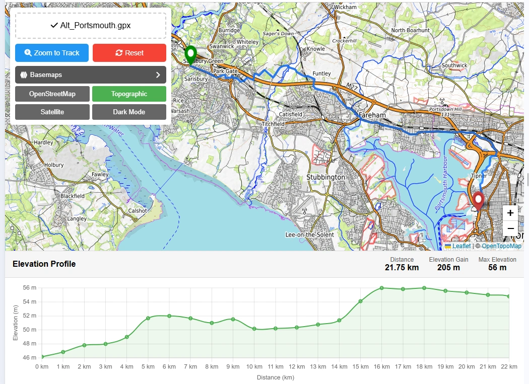
Elevation Profile
Do you want to display GPS data in .gpx format on map and get elevation profile?
View GPX data on map with street view, satellite view, topographic view and dark theme map view as a base map. GPX online viewer is a free and user-friendly online web mapping tool for viewing your GPX tracks files. To get started, just drag your GPX file into the upload area or browse to locate your file in your local directory computer or phone. Our online GPX viewer is 100% free to use and all technologies & datasets are copyright free and works with all modern browser like Chrome, Opera and Firefox etc. You can view your recorded hiking, cycling or any other outdoor activity. This gpx online viewer will show your tracks on map online and will provide total distance covered with elevation profile.
To get started, just drag your GPX file into the upload area or browse to locate your file in your local directory computer or phone. Our online GPX viewer is 100% free to use and all technologies & datasets are copyright free and works with all modern browser like Chrome, Opera and Firefox etc.
You can view your recorded hiking, cycling or any other outdoor activity. This gpx online viewer will show your tracks on map online and will provide total distance covered with elevation profile.
Free GPX Viewer App Key Features:
User Guide: Step by Step Guide to Use GPX Viewer Online:
This guide will help to use online gpx reader to display data on map using free mapping tools.
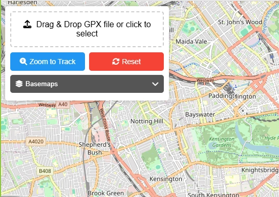
Step 1: Drag & Drop GPX File or Select File from Local Storage
You will have 2 options to upload your gpx file in this gpx file reader. Drag and drop your file in dedicated box as shown in above picture or select file by clicking the box and browse file from your local storage to select and upload.
Step 2: Map Zoom to Data Extent
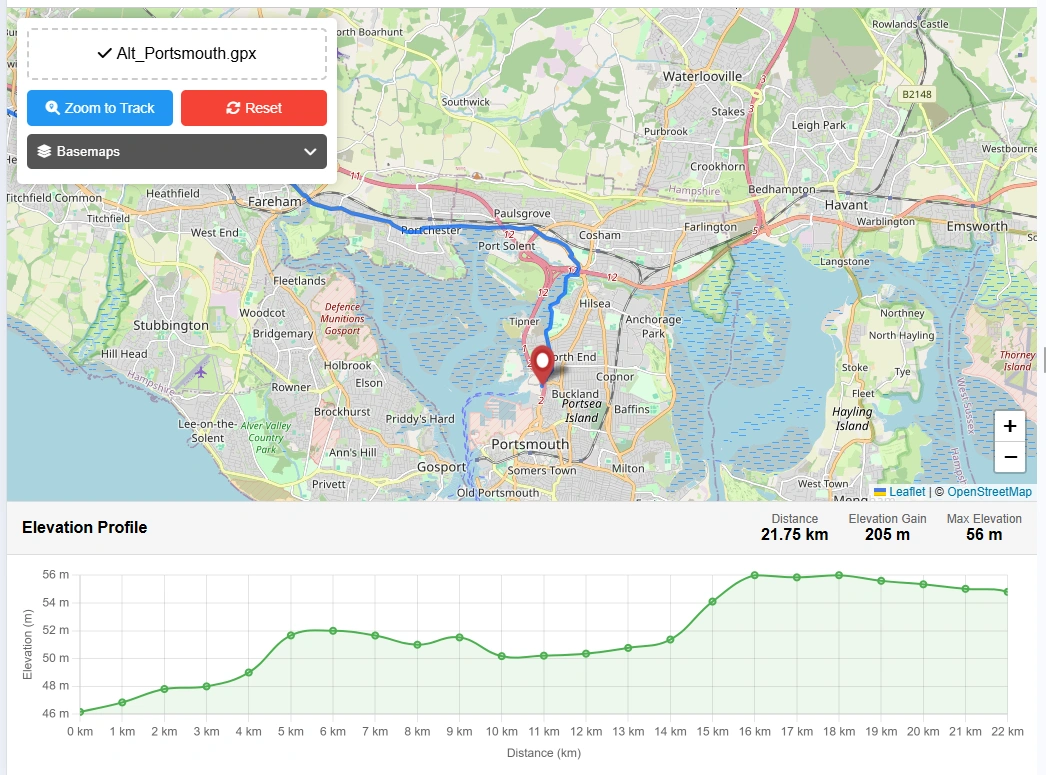
When file will be uploaded then data will be automatically extracted by gpx viewer online application. Map will be zoomed automatically to the extent of gpx data stored in file (Note: GPX file must have track data to display.) This free gpx viewer web tool will provide useful information extracted from data.
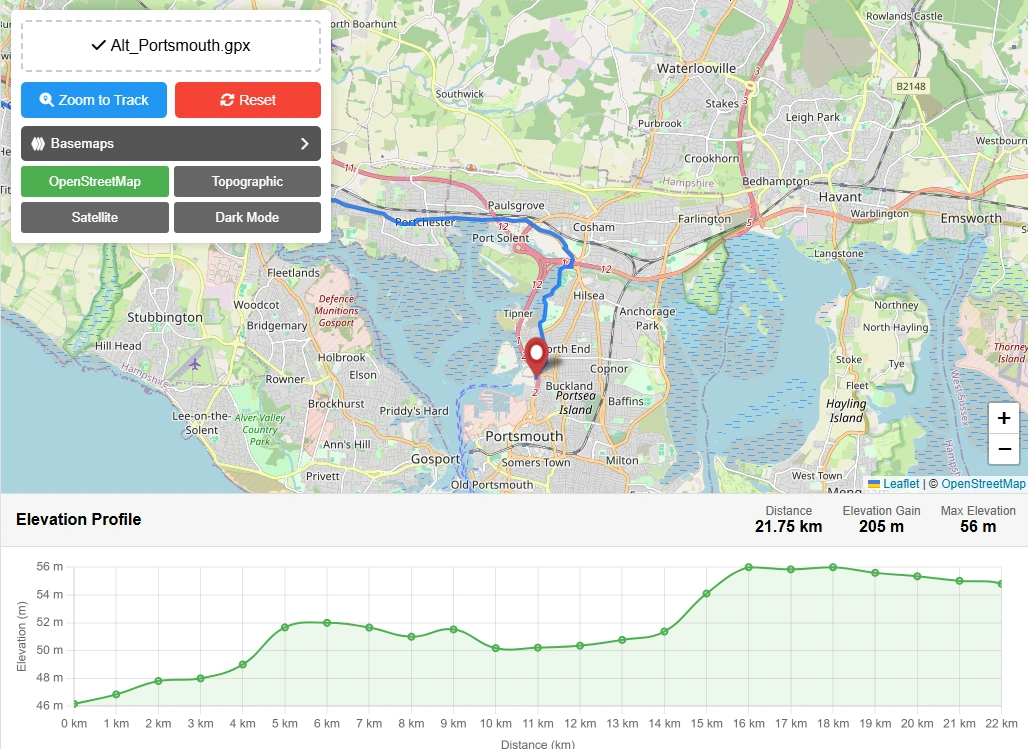
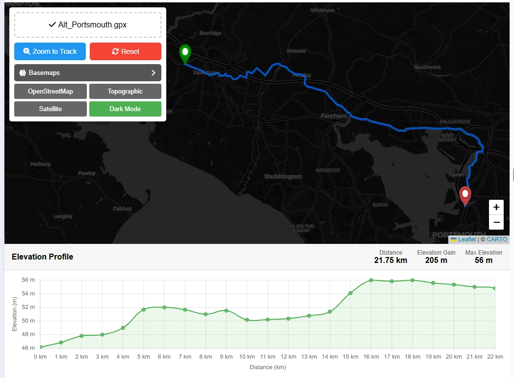
Step 3: Change Base Map
There will be 4 options to change the basemap in this gpx file reader on map.
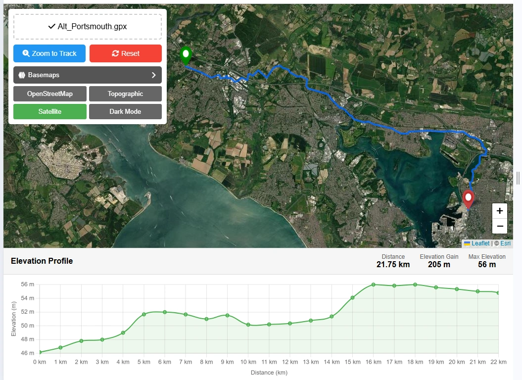
Step 4: Zoom to Track
Zoom to track button will zoom the data to it original data extent.
Step 5: Reset Map
Reset button will clear all the data and reset the application to its original state to reupload the GPX file.
Open Source Resources